
03 · Atlas
Period: 1916 Post-Ottoman Middle East Risk: Medium
1916 · Secret Partition Map
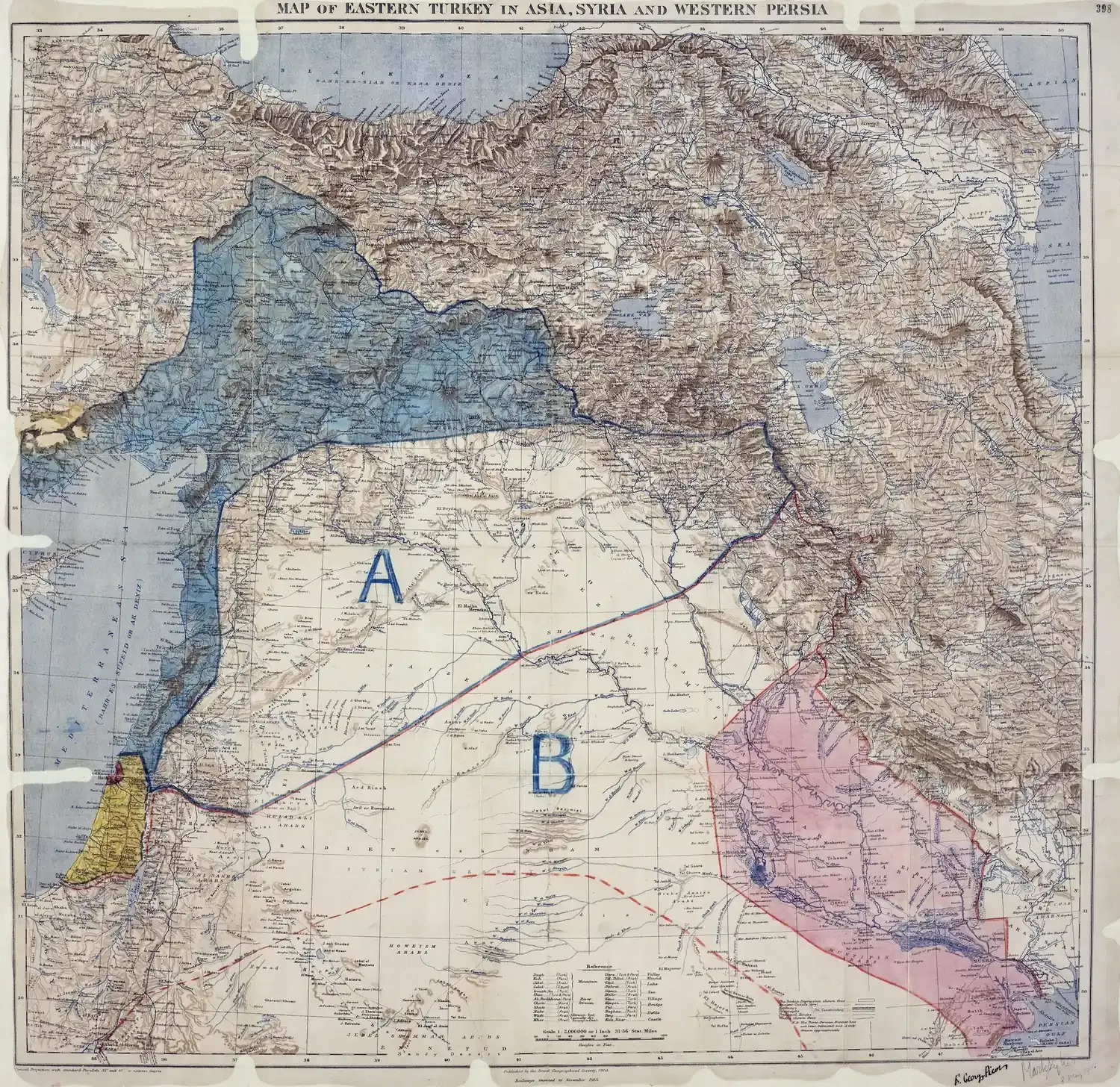
The Sykes–Picot map is an important document-map showing how the post-Ottoman Middle East was imagined during the First World War through British and French zones of influence. It demonstrates that the postwar order was shaped not only on the battlefield, but also at the diplomatic table.
This map should not be read as the single and direct explanation of today’s borders. A more accurate reading is this: Sykes–Picot was an interim document showing wartime visions of external powers and the logic of influence-sharing over the region; later developments modified, limited, and reshaped that vision.