
03 · Atlas
Period: 1904 Inner Eurasian landmass (Heartland) Risk: Low
1904 · Heartland Thesis
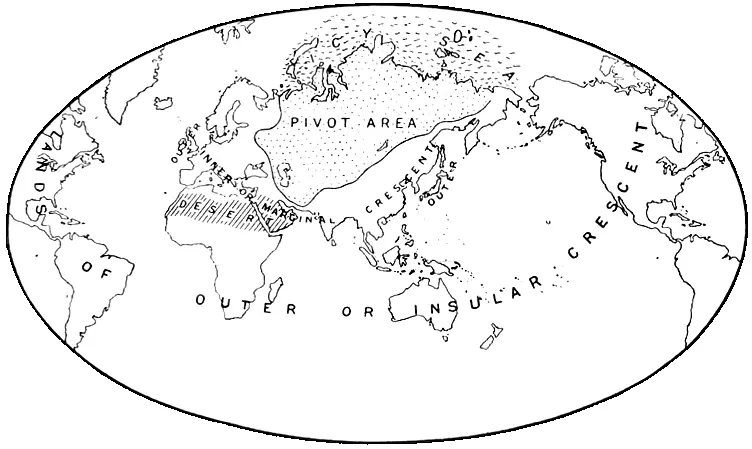
Mackinder’s Heartland map is one of the classic geopolitical schemes that interpreted the inner landmass of Eurasia as a central strategic zone in world politics. The map presents the relationship between land power, sea power, transport routes, and imperial rivalry within a theoretical framework.
This is not an event map in the direct sense, but a map of thought. In the OWS Atlas, its function is not to show the details of a particular war, but to illustrate how space was abstracted and transformed into a strategic model in twentieth-century geopolitical thinking.