
03 · Atlas
Period: 1962 Cuba, Caribbean, US eastern seaboard Risk: High
1962 · Nuclear Range Map
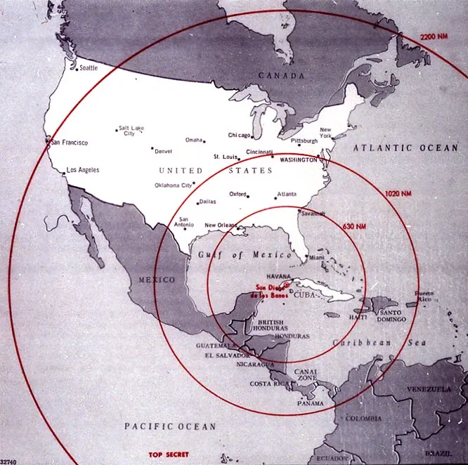
This range map, used during the Cuban Missile Crisis, shows which parts of the United States could be reached by Soviet missiles launched from Cuba. It demonstrates that the crisis was not merely an abstract ideological confrontation; it was also structured by measurable factors such as distance, time, range, and target area.
Maps of this kind are important for understanding how decision-makers perceived threat. The map does not explain the crisis by itself, but it makes visible how geography and technical range data placed pressure on political decision-making during a crisis.